Landowners adjacent to the Pembina River remain stuck between a lack of provincial regulations regarding floodplain developments, and a Westlock County overlay with strict requirements.
At Westlock County’s July 16 council meeting, county ratepayer Terry Sheehan along with 10 other landowners were part of a delegation to speak on the issue of the county’s requirements for allowing buildings on existing farmsteads identified as flood hazard areas in the municipal development plan (MDP).
Around 40 people were present at the meeting to hear from councillors on the issue.
At a previous meeting June 19, the overlay was discussed with county planner Jane Dauphinee. County CAO Leo Ludwig brought up the flood in southern Alberta in 2013, upon which the provincial government based new legislation at the time in the form of Bill 27 to prevent building in flood hazard areas.
However, no further regulation came from the province and municipalities were required to provide their own.
“The province said ‘Do your due diligence and we’ll get you regulation that will define it further.’ We still don’t have the regulation, but we still have the obligation of due diligence,” said Ludwig after the meeting.
“We feel that the intent of the (provincial) government’s draft regulation was never directed towards existing farmsteads. There is no mention of them. It is obvious that new subdivisions in the floodplain for residential use was their concern,” Sheehan said during the meeting.
“I remember Jane Dauphinee saying at the special county meeting that you can do whatever you choose to,” said Sheehan, pointing out other counties have fewer requirements for similar situations.
Further, Sheehan added the discussion at the time was focused on new subdivisions, not existing developments.
There is also the issue of the overlay being introduced into the MDP in 2016, when development was allowed previously. There was no public consultation prior to the changes to the MDP, nor a notice to landowners following the new MDP, Sheehan told council.
The map which identifies flood hazard on the river was first introduced into the Land Use Bylaw by at least 1998, but the requirements were different.
“Some of the flood policies that relate to that map are newer … but that’s because of the change that was made by the province in 2014 (with Bill 27),” confirmed Ludwig.
Over time, farmers continued to develop on their lands, which now all fall under the restrictive overlay.
“How can you allow people along the river to develop and increase their financial commitment for 30 years, and then all of a sudden implement a policy like this?” asked Sheehan. “This policy definitely wasn’t a reaction to something that happened on the river. We haven’t had a flood for 34 years.”
Coun. Jared Stitsen expressed sympathy for landowners’ situation.
Coun. Fred Slobodian had also pressed the urban planner at the June 19 meeting about the impact of this overlay on farmers in the area.
Council maintains it is following suit with regulation from the province. This, however, is what landowners like Sheehan take issue with.
“Most counties have some sort of agricultural exemptions, or some sort of policy that would make farm yards exempt. They either don’t ask for permits for accessory buildings in an agricultural yard or they have very few limitations,” after the meeting.
“We have checked with other counties: Lac St. Anne, Barrhead, Athabasca, Sturgeon, Slave River, Sturgeon … We know there’s no other policy in place in those other counties that resembles this one.”
There are also liability concerns for the municipality, namely legal action from landowners who are granted permits if their property floods and causes damage.
In the county meeting agenda package, a letter from county lawyer Lorne I. Randa lists three legal precedents in Edmonton.
Sheehan, however, thinks the risk existed prior to the 2016 MDP changes as well and there was no change to have prompted the risk factor to increase as there’s been no flood since 1986.
Property devaluation, Sheehan said, is also a liability to the county which council did not consider as an after-effect of the restrictive overlay. Sheehan said he is aware of cases like this in the region.
Sheehan said he first became aware of the new requirements two months ago.
“We wanted to apply (for a development permit to build a full structure on the farm), but that’s when we found out that we wouldn’t be accepted until we did … a bunch of engineering,” said Sheehan.
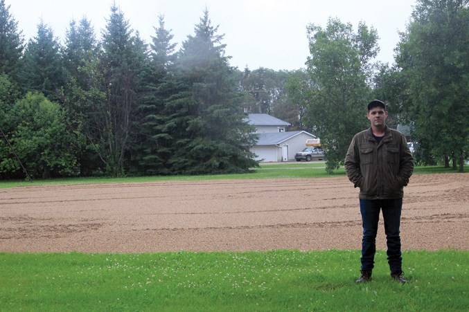
Gabe Sheehan, Terry’s 22-year-old son, showed the Westlock News the place on the property where they intend to build the structure, directly down from the existing house. When asked about the river, Gabe said it runs about three miles away from their farmstead, across Township Road 610.
The engineering Terry Sheehan referenced is underlined in section 5.3.4 of the MDP, which states that proposals for development other than agricultural cultivation be accompanied by a survey prepared by an Alberta land surveyor showing the 1:100 flood limit or a flood susceptibility and/or bank stability analysis prepared by a registered engineer.
“They cost a lot of money, probably around $30,000, but our whole project is probably under $100,000. And that doesn’t guarantee you anything.”
There is a worry for landowners that should they engage with the overlay and conduct the necessary studies on their properties, the permit they are applying for might not be granted, but the cost will remain.
“We’re farmers, we’ve been there for a long time, we know our buildings are safe and can survive those floods,” said Sheehan, who was there for the 1986 flood as well.
Ultimately, councillors urged landowners to seek answers at the provincial level and previously passed a motion to meet with Athabasca-Barrhead-Westlock MLA Glenn van Dijken on the issue. He is aware of landowners’ concerns and has spoken to a number of them.
Currently, the flood hazard map for the Pembina River, which was created by the province on the basis of aerial and ground photographs at the time of the 1986 flood, has no other studies (bank analysis, geology etc.) to support the delineation of flood hazard.
Whether the province will conduct the necessary studies on the river remains an unknown.
For the county to engage in a GIS study of the river instead would be too cost-prohibitive, said deputy reeve Coleman.
“Administration has asked for some pricing on it … I’m guessing it would cost around $1 million dollars,” he said.
The overlay in the MDP applies to about 80 landowners.
As for the Sheehan family, Gabe is reconsidering his options. The current flood hazard status of their property put a hold on his plans to continue developing the farm. Although he intended to take over from his parents, Gabe is now skeptical of his future in the county unless the restrictions on development are changed.
“It seems like the county wants us gone,” he said.


